





NCERT Solutions for Class 12 Geography: Chapter-Wise Guide
NCERT Solutions for Class 12 Geography sits at an odd crossroads. It's a Humanities subject, but it behaves like a hybrid of theory, statistics, and cartography. One day you're writing about demographic transition theory, and the next you're plotting iron-ore mines on a blank map of India. That dual nature is exactly why students either find it one of the easiest-scoring subjects in the Arts stream — or one of the most confusing, simply because they study it like a History or Political Science paper instead of treating maps, data, and diagrams as core scoring tools.
This guide breaks the subject down the way it's actually structured for the board exam: book by book, chapter by chapter, with the real CBSE mark distribution, so you know exactly where to spend your revision hours.
Fundamentals of Human Geography | India - People & Economy |
|---|---|
1. Human Geography – Nature and Scope | 1. Population – Distribution & Growth |
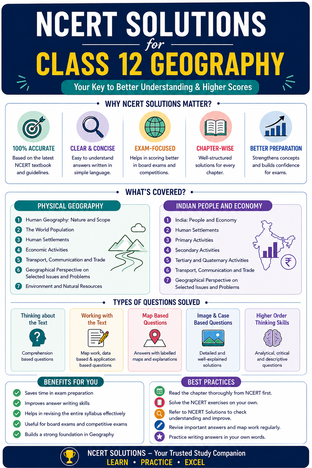
Why NCERT Solutions Matter More in Geography Than in Any Other Humanities Subject
In subjects like History or Political Science, marks are largely about how well you write and structure an answer. In Geography, marks come from three different skill sets at once:
- Conceptual accuracy — definitions, processes, and classifications (e.g., types of farming, stages of demographic transition)
- Application through diagrams — population pyramids, flowcharts, and graphs that the marking scheme specifically rewards
- Spatial knowledge — map-based identification, which carries a fixed, guaranteed 5 marks in each theory paper
NCERT Solutions help because the textbook language itself is the answer-writing language CBSE examiners expect. Geography solutions that paraphrase loosely or skip diagrams cost students marks even when the "concept" is technically correct. A solution is only useful if it mirrors how the NCERT defines a term and then shows the diagram or example that the marking scheme is built around.
The Three NCERT Books for Class 12 Geography
CBSE prescribes three textbooks, and each plays a distinct role in the final result.
| Book | Chapters | Theory Weightage | Focus Area |
|---|---|---|---|
| Fundamentals of Human Geography | 8 chapters | 35 marks | World-level concepts — population, human development, economic activities, trade, transport |
| India: People and Economy | 9 chapters | 35 marks | India-specific resources, agriculture, settlements, planning, and contemporary issues |
| Practical Work in Geography – Part II | 4 chapters | 30 marks (practical exam) | Data handling, statistical diagrams, GIS and spatial technology |
Together, these three books form a 100-mark Geography paper for the academic session — 70 for theory and 30 for the practical examination, including the internal practical file and viva.
Chapter-Wise List with NCERT Solutions Focus
Book 1: Fundamentals of Human Geography
| Ch. | Chapter Name | Key Concepts to Master | Solutions Should Emphasise |
|---|---|---|---|
| 1 | Human Geography: Nature and Scope | Regional vs systematic approach, dualism, naturalisation of humans/humanisation of nature | One-line definitions of each school of thought; this chapter is mostly conceptual recall |
| 2 | The World Population: Distribution, Density and Growth | Factors affecting distribution, components of population change, demographic transition theory | The 3-stage demographic transition diagram; this is a near-guaranteed diagram-based question |
| 3 | Human Development | Four pillars of human development, HDI, HPI, GNH | Comparison table of HDI vs HPI vs GNH — examiners reward distinctions, not just definitions |
| 4 | Primary Activities | Hunting, gathering, pastoralism, types of subsistence and commercial farming, mining | Tabular comparison of intensive vs extensive vs plantation agriculture |
| 5 | Secondary Activities | Characteristics of modern manufacturing, factors of industrial location, high-tech industry | Classification chart: size, raw material, output, ownership |
| 6 | Tertiary and Quaternary Activities | Trade and commerce, transport, the digital divide, quaternary/quinary activities | Clear distinction table between tertiary, quaternary and quinary work |
| 7 | Transport and Communication | Roadways, railways (transcontinental routes), sea routes, air routes, pipelines | Map-marking practice — this chapter alone carries fixed map items every year |
| 8 | International Trade | Balance of trade, dumping, WTO, regional trade blocs, port types | Flowchart of bilateral vs multilateral trade with current examples |
Book 2: India — People and Economy
| Ch. | Chapter Name | Key Concepts to Master | Solutions Should Emphasise |
|---|---|---|---|
| 1 | Population: Distribution, Density, Growth and Composition | Regional variation in growth, working population composition, Beti Bachao–Beti Padhao | State-wise density comparisons; frequently asked as a source-based question |
| 2 | Human Settlements | Rural settlement types and patterns, urbanisation in India, Smart Cities Mission | Classification chart of settlement patterns (linear, nucleated, dispersed) |
| 3 | Land Resources and Agriculture | Land-use categories, cropping seasons, geographical conditions for wheat/rice/cotton/jute/tea/coffee | Crop-wise table of climatic needs and leading producer states — this is the single highest-yield table in the entire syllabus |
| 4 | Water Resources | Surface vs groundwater, irrigation demand, rainwater harvesting, watershed management | Causes-and-solutions format for water pollution and conservation |
| 5 | Mineral and Energy Resources | Ferrous/non-ferrous minerals, conventional vs non-conventional energy | Mine-location table (Bailadila, Jharia, Hazaribagh, etc.) tied directly to map work |
| 6 | Planning and Sustainable Development | Target area planning, Bharmaur ITDP case study, Indira Gandhi Canal case study | Case-study structure: problem, plan, outcome |
| 7 | Transport and Communication (India) | Road, rail, pipeline, inland waterways, personal vs mass communication | Diagram of National Waterways and major rail zones |
| 8 | International Trade (India) | Changing export-import composition, direction of trade, major seaports and hinterlands | Port-hinterland matching table — a recurring map-based question |
| 9 | Geographical Perspective on Selected Issues and Problems | Urban waste disposal, rural-urban migration, slums, land degradation | Case-study answers with cause → impact → mitigation structure |
Book 3: Practical Work in Geography – Part II
| Ch. | Chapter Name | Key Skills |
|---|---|---|
| 1 | Data: Its Source and Compilation | Primary/secondary/unpublished data, tabulation, frequency polygon |
| 2 | Data Processing | Mean, median, mode, and their comparative use |
| 3 | Graphical Representation of Data | Bar diagrams, pie diagrams, choropleth and isopleth maps |
| 4 | Spatial Information Technology | GIS components, spatial data formats, overlay and buffer analysis |
This practical book is consistently underprepared by students, yet it accounts for 30 direct marks through a written exam, practical file, and viva — making it one of the most time-efficient places to secure marks with minimal memorisation.
Class 12 Geography NCERT Solutions – Chapter-wise Breakdown
The Class 12 Geography syllabus is divided into two parts:
Part 1: Fundamentals of Human Geography
This section explores how human activities interact with the environment. The key chapters include:
- Human Geography – Nature and Scope – Understanding human geography and its importance.
- The World Population – Distribution, Density, and Growth – Factors affecting population changes.
- Human Development – Measures of human progress.
- Primary Activities – Farming, fishing, mining, and more.
- Secondary Activities – Industrialization and manufacturing industries.
- Tertiary & Quaternary Activities – Services and knowledge-based economies.
- Transport and Communication – Global connectivity and networks.
- International Trade – Import-export dynamics and trade agreements.
- Human Settlements – Urban and rural settlements.
Each NCERT solution for Class 12 Geography provides clear explanations, examples, and diagrams for these topics, making learning effective.
Part 2: India – People and Economy
This section focuses on India’s geographical diversity, economic activities, and development strategies. It includes:
- Population – Distribution, Density, and Growth – Census data analysis.
- Migration – Types, Causes, and Consequences – Internal and international migration trends.
- Human Development in India – Education, healthcare, and quality of life.
- Land Resources and Agriculture – Indian agriculture and land use.
- Water Resources – Water availability and conservation.
- Mineral and Energy Resources – Sustainable resource management.
- Industries in India – Growth and development of industrial sectors.
- Transport, Communication, and International Trade – Networks that support India’s economy.
- Geographical Perspective on Selected Issues and Problems – Environmental concerns and urbanisation challenges.
With NCERT Class 12 Geography solutions, students can understand these topics thoroughly, answer questions confidently, and improve their analytical skills.
How NCERT Solutions Help in Exam Preparation
Many students struggle with Geography due to its wide syllabus, map-based questions, and descriptive answers. NCERT Solutions for Class 12 Geography help in:
Better Retention: Well-structured answers help students retain information longer.
Time Management: Understanding concepts clearly reduces last-minute cramming.
Improved Writing Skills: Solutions guide students on framing structured answers.
Higher Scores: By following NCERT solutions, students can write answers that match CBSE’s marking scheme, improving their final scores.
CBSE Class 12 Geography: Exam Pattern and Mark Distribution
Here's how the 100 marks actually break down for the board exam.
| Component | Marks | Details |
|---|---|---|
| Theory Paper (Fundamentals of Human Geography + India: People and Economy) | 70 | Combines both books; includes MCQs, short-answer, long-answer, and source-based questions |
| — World Map Work | 5 | Identification of physical/political features on the world map |
| — India Map Work | 5 | Marking and labelling on the political map of India |
| Practical Examination | 30 | Written exam (25) + practical file (2) + viva voce (3) |
| Total | 100 |
Within the 70-mark theory paper, the unit-wise weightage is:
| Book | Unit | Topics | Marks |
|---|---|---|---|
| Fundamentals of Human Geography | Unit I | Human Geography: Nature and Scope | 3 |
| Unit II | World Population, Human Development | 8 | |
| Unit III | Primary, Secondary, Tertiary Activities, Transport, International Trade | 19 | |
| Map Work | World map identification | 5 | |
| India: People and Economy | Unit I | Population | 5 |
| Unit II | Human Settlements | 3 | |
| Unit III | Land Resources, Water Resources, Minerals, Planning | 10 | |
| Unit IV | Transport, Communication, International Trade | 7 | |
| Unit V | Geographical Issues and Problems | 5 | |
| Map Work | India map marking | 5 |
The cognitive-level split set by CBSE for the question paper design is also worth knowing, since it tells you how much rote learning versus applied thinking the paper actually tests:
| Cognitive Domain | Description | Weightage |
|---|---|---|
| Remembering and Understanding | Recalling facts, terms, and definitions; describing and interpreting | 41% |
| Application | Using concepts in new situations or unfamiliar contexts | 37% |
| Analysing, Evaluating, Creating | Comparing, inferring, building new structures from given data | 22% |
The takeaway: nearly 60% of the paper rewards application and analysis, not pure memorisation. This is exactly why answer structure, diagrams, and comparative tables matter as much as knowing the definitions.
High-Weightage Chapters Worth Prioritising
If your revision time is limited, focus disproportionately on:
- Land Resources and Agriculture and Mineral and Energy Resources — together they anchor Unit III of Book 2 and dominate map-based questions
- Primary, Secondary, and Tertiary Activities — the single highest-weightage unit (19 marks) in Book 1
- Transport and Communication (both world and India versions) — guarantees map marks every year
- International Trade — appears in both books and is a favourite for source-based questions
- Planning and Sustainable Development — case studies here are predictable and easy to score full marks on if practised once properly
How to Use NCERT Solutions for Real Exam Gains
- Read the NCERT line first, then the solution. The solution should clarify, not replace, the textbook's own phrasing — examiners are trained on NCERT language.
- Build your own comparison tables while studying, similar to the ones above, instead of only reading prepared ones. The act of constructing a table (intensive vs extensive farming, tertiary vs quaternary) cements the distinction far better than reading it.
- Practice every map item from the syllabus at least three times — mines, ports, airports, and transcontinental railway terminals are fixed, finite lists. There is no ambiguity here, so these are the easiest 10 marks (5+5) on the entire paper.
- Don't skip the practical book. Many students leave Data Processing and Spatial Information Technology for the last week. These chapters need almost no memorisation — just method — and contribute 30 marks.
- Convert long-answer chapters into flowcharts. Chapters like International Trade or Tertiary and Quaternary Activities read better as a flowchart than as paragraphs, and flowcharts are explicitly rewarded by the CBSE marking scheme.
Final Word
Class 12 Geography rewards structured, visual answer-writing far more than long prose. The chapters with tables, diagrams, and maps built into the NCERT text — Agriculture, Minerals, Transport, Trade — are also the chapters where solutions help the most, because they show you exactly how to translate text into the diagram or table an examiner is scanning for. Treat the subject as a mix of geography facts and presentation skills, and the 100-mark paper becomes considerably easier to manage in the time you have before the board exam.
FAQs for NCERT Solutions for Class 12 Geography
NCERT Solutions for Class 12 Geography are essential because they help students understand geographical concepts, maps, case studies, and data-based questions in a simple and organized manner. Geography involves both theoretical knowledge and analytical skills, making concept clarity very important. These solutions explain topics related to human geography, population, resources, transport, and geographical perspectives in an easy-to-understand format. Students can learn how to frame answers effectively and present geographical facts accurately. Regular practice of NCERT Solutions improves understanding of important concepts and helps students retain information for a longer period. Since many board examination questions are based directly on NCERT content, studying these solutions thoroughly can significantly improve examination performance and confidence.
Students can avoid common mistakes by understanding concepts thoroughly and practicing answer writing regularly. Geography answers should be clear, well-organized, and supported with relevant facts or examples whenever possible. Reading questions carefully before answering helps prevent misunderstandings. Students should also revise maps, definitions, and case studies regularly to improve recall. Proper time management during examinations is important because lengthy answers can consume valuable time. Writing neat and structured answers with headings and points improves presentation. Consistent study of NCERT Solutions helps students understand the correct approach to answering questions and reduces common errors, resulting in better examination performance.
Every exercise question in the Geography textbook is designed to strengthen understanding of important concepts and topics. Solving all questions ensures complete coverage of the syllabus and exposes students to different types of examination questions. These exercises help students develop answer-writing skills, improve conceptual clarity, and strengthen memory retention. Many board examination questions are based directly or indirectly on textbook exercises. Regular practice also helps students become familiar with important geographical terms and concepts. By solving every question thoroughly, students can identify weak areas and improve their preparation, ultimately increasing their confidence and performance in examinations.
Human Geography focuses on the relationship between people and their environment, including population, settlements, economic activities, and development patterns. NCERT Solutions explain these concepts in a simple and systematic way, making them easier to understand. Students learn how human activities influence geographical regions and how different factors affect development. The solutions also provide examples and explanations that help connect theoretical concepts with real-world situations. This practical understanding improves analytical thinking and helps students answer examination questions more effectively. By studying NCERT Solutions regularly, students gain a deeper understanding of human geography and its relevance in everyday life.
Map work is an important component of Geography because it helps students visualize geographical information and understand spatial relationships. Many examination questions require students to identify locations, regions, transport routes, and resource distribution on maps. NCERT Solutions often explain map-related concepts and provide context for geographical patterns. Practicing map work regularly improves observation skills and helps students remember important locations more effectively. Accurate map labeling and interpretation can also contribute to higher marks in examinations. By combining theoretical knowledge with map practice, students develop a more comprehensive understanding of geography and improve their ability to answer geographical questions confidently.
NCERT Solutions are excellent revision tools because they provide chapter-wise explanations and organized answers. Students can begin by revising key concepts, definitions, and summaries from each chapter. After reviewing the theory, they should attempt textbook questions independently before checking the solutions. This approach helps identify weak areas and improves understanding. Preparing short notes from important topics can make last-minute revision more effective. Students should also revise maps, case studies, and geographical terms regularly. Consistent revision using NCERT Solutions helps improve memory retention and ensures that important concepts remain fresh before examinations, leading to greater confidence and better performance.
NCERT Solutions help students score better marks by providing accurate and well-structured answers to textbook questions. Geography examinations often require students to explain concepts, interpret data, and write descriptive answers. These solutions demonstrate the proper format for answering different types of questions. Students learn how to include relevant geographical terms, examples, and explanations that can improve answer quality. Regular practice also strengthens conceptual understanding and enhances recall ability during examinations. By studying chapter-wise solutions consistently, students become familiar with important topics and frequently asked questions. This preparation increases confidence and helps students write more effective answers, leading to better scores in board examinations.
Yes, NCERT Solutions for Class 12 Geography can be very useful for competitive examinations that include geography-related topics. These solutions build a strong foundation in areas such as population distribution, resource management, transport systems, and regional development. Many competitive examinations test conceptual understanding rather than rote memorization, and NCERT helps students develop this understanding. The solutions simplify complex topics and explain them logically, making learning easier. Students who thoroughly study NCERT concepts often find it easier to understand advanced geography topics later. Therefore, NCERT Solutions not only help in board examinations but also support preparation for various entrance and competitive examinations that include geography as a subject.
Several chapters in Class 12 Geography are considered highly important because of their conceptual significance and examination weightage. Topics related to Population Distribution, Human Settlements, Land Resources and Agriculture, Transport and Communication, International Trade, Human Development, and Planning and Sustainable Development frequently appear in examinations. These chapters help students understand geographical patterns, development issues, and economic activities. Students should focus on important definitions, maps, case studies, and data interpretation questions within these chapters. Consistent revision and practice of these topics can improve understanding and increase confidence. Mastering these key chapters often contributes significantly to overall examination performance and marks.
NCERT Solutions provide a strong foundation for scoring high marks because they cover all textbook questions and important concepts in detail. Students who thoroughly understand the chapters and practice answer writing regularly can achieve excellent results. However, high scores also depend on effective revision, map practice, and the ability to present answers clearly. Students should focus on understanding concepts rather than memorizing answers. Revising important terms, diagrams, maps, and case studies can further improve performance. By combining regular study of NCERT Solutions with consistent practice and revision, students can significantly increase their chances of scoring high marks in Class 12 Geography examinations.